

What is the conditions like in Vöyri River right now?
An automatic measuring station has been installed in Vöyri River, in western Finland. Here you can follow along how the water level, pH and Conductivity is changing with time and weather.
What is being measured?
The graph shows the pH, Conductivity, and Water level in Vöyri River.
- The pH shows how acidic the water is in the River. The more acidic the water is, the lower the pH is. Normal drinking water usually has a pH around 7. Acid sulfate soils usually has a pH less than 4.0. Water that is discharged from acid sulfate soils can therefore be very acidic. If the pH in the recipient river drops to below 5.5, this can start begin to harm the ecosystem and fishes within the waters.
- The electrical conductivity reflects the amount of soluble material (ions) in the water. This is why the conductivity usually rises when more sulfur and metals are leached from the surrounding acid sulfate soils. The conductivity (along with pH) is therefore an indicator for how big the environmental impact is in the water body.
- The water level shows how much water there is in Vöyri River right now. After rainfall the water level rises notably, and then slowly decrease until the next rainfall.
The measuring station
An automatic measuring station has been installed within Vöyri River, western Finland, and is continuously measures the water quality. The measuring stations has been placed on behalf of the MASSIW project, and has been installed by Masinotek. The graph can be viewed above, and here you can follow how conditions change with time and changing weather. The graph is continuously updated and thus reflect that current situation.
The image shows the location where the measuring station was installed.
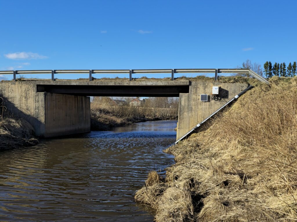
Vöyri River
Vöyri River runs through a fertile valley in Vöyri, western Finland. It is an important agricultural area that has also been historically been called “the Kingdom of Rye” (original in Swedish: “rågens rike”). The river is about 35 km long and discharges into the shallow coastal brackish waters in the Baltic Sea. The catchment area encompasses 223 km² land and consists of mainly forests, agricultural lands, and bogs.
Large parts of the area has soils with underlying old marine sediments, containing iron sulfides. When these soils are ditched and the groundwater-level is lowered, these underlying sediments come into contact with oxygen. Iron sulfides react with oxygen to form acid sulfate soils. This can lead to high amounts of acidity in nearby rivers and streams, and also release soluble metals from the soils into the waters. These waters discharge into the brackish Baltic Sea. Thus, the discharge from acid sulfate soils can affect both the river itself, as well as the coastal environment. Vöyri River shows the close connection between the areas geological history, land use, and the watersystem. With smart water management the goal is to both improve the growing conditions and reduce the negative impacts of acid sulfate soils at the same time.
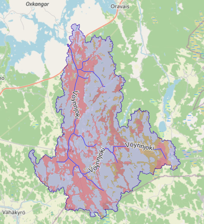
Vöyri River catchment area in Österbotten, Finland.
